
Recently, the "Beidou Navigation-based Enhanced Precision Spatiotemporal Integrated Service Platform," completed through the collaboration between the Chongqing Institute of Green and Intelligent Technology, Chinese Academy of Sciences and Tiankan Surveying Group, has been recognized as reaching the international advanced level by industry experts organized by the Tianjin Municipal Science and Technology Bureau.
As a key R&D project of Tianjin, this project has developed a precise spatiotemporal integrated service platform covering the Tianjin area, mainly based on the Beidou Navigation system. It proposes a new approach to intelligent pre-processing with environmental adaptability and has developed a small, highly integrated, low-power, low-cost, and universal intelligent monitoring Beidou Navigation terminal. Since its establishment, this platform has been widely applied in various fields, effectively promoting the high-precision PNT (Positioning, Navigation, and Timing) service of the Beidou Navigation system and demonstrating promising prospects in the spatiotemporal service industry.
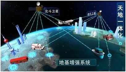
Figure 1: Beidou Navigation-based Enhanced Precision Spatiotemporal Integrated Service Platform
In the field of surveying and mapping, more than 20 surveying and mapping companies in Tianjin, including Tiankan Surveying Group, use the Beidou Navigation-based enhanced system. The real-time positioning function of the Beidou Navigation-based enhanced system has replaced traditional surveying methods such as wire surveying and GNSS static surveying in the main production businesses of Tiankan Surveying Group, such as geotechnical engineering survey, urban and rural planning supervision survey, real estate survey of land resources, and engineering construction survey. This has achieved significant economic and social benefits.
In the field of environmental protection, various measurement methods, such as the precise positioning technology of Beidou Navigation and oblique photography by drones, are comprehensively utilized to provide boundary marking services for the ecological red line for the Tianjin Environmental Protection Bureau. This has generated various forms of geospatial data, such as DEM, DOM, and 3D models, to provide accurate benchmarks for ecological environment protection.

Figure 2: "Boundary Marking for Ecological Red Line" Service
In the field of security, the high-precision pipeline inspection and unified access management and positioning services for Tianjin Eco-City Investment and Development Co., Ltd. are provided. By integrating the precise positioning technology of Beidou Navigation and GIS technology, a spatial reference system based on Beidou Navigation positioning is established, enabling high-precision positioning for inspections and providing important positional data for the inspection work of the eco-city. The automation level of the inspection work is improved by unifying the access management service for vehicle and personnel positioning GPS devices, displaying vehicle and personnel positioning devices on the system, supporting the loading and display of various GIS map data, and supporting real-time querying of positioning device information.
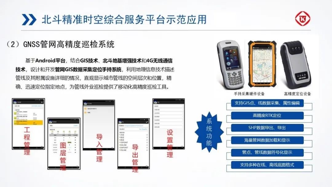
Figure 3: High-Precision Pipeline Inspection Service
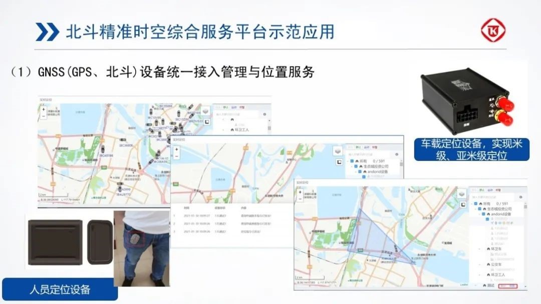
Figure 4: Unified Access Management and Positioning Service for Positioning Devices